Proposals
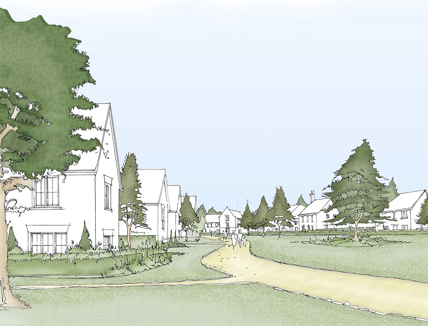
Our vision for a landscaped-led development
Our vision is to deliver a vibrant, high-quality development that responds to the existing landscape that naturally integrates with the wider area of Billericay. The development will deliver new homes, create public green spaces through new landscaped routes enhancing connectivity all while helping meet local needs.
Key features
Benefits for the area and the community
- 250 high-quality new homes including 50% affordable
- Mix of 1-bedroom to 5-bedroom homes providing opportunities for people to stay in an area they call home
- Short walking/cycling distance to Billericay train station, the High Street, school, shops and amenities
- New pedestrian and cycle links through Firthwood Lane connecting to the wider area of Billericay
- Retention of existing trees and hedgerows with significant landscaping to be retained and enhanced
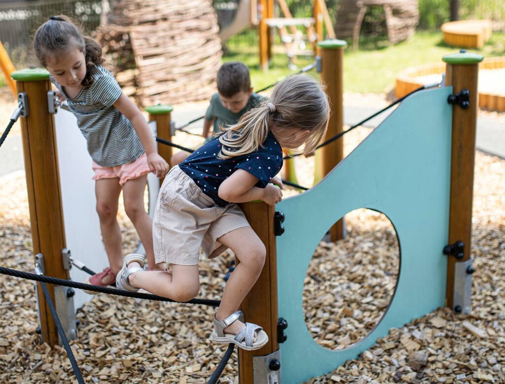
- Extensive landscaping and green open space for all to enjoy including new children’s play equipment
- Sensitivity designed scheme based on the parameters agreed at Outline stage
- Sustainable drainage features
- Biodiversity enhancements
- Financial contributions to healthcare and education

The site
Site location
The site lies just south of Billericay’s built-up area, with direct access from Laindon Road.
It is made up of three areas of former agricultural land that sit between Laindon Road to the east and Frithwood Lane to the west.
The location is close to Billericay town centre, with the High Street, train station, schools, shops and community facilities all within walking or cycling distance. The surrounding network of open spaces, sports facilities and parks, including Laindon Common and the Queen Elizabeth II Fields, helps to create an attractive and well-connected setting for a new development.
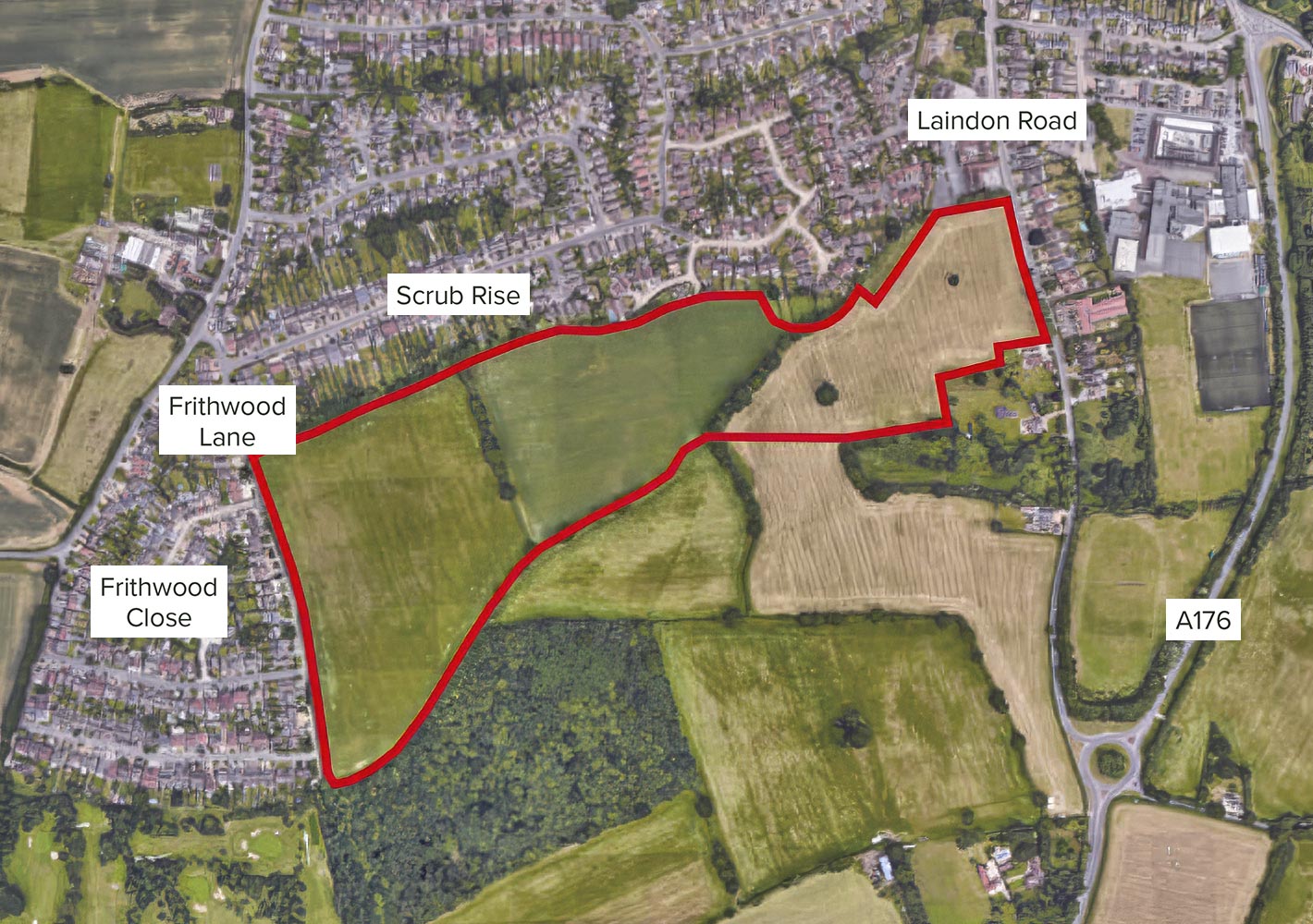
- 1Laindon Road
- 2Access off Laindon Road
- 3Scrub Rise
- 4Pedestrian and cycle paths through to Frithwood
- 5Ancient woodland
- 6Pedestrian and cycle paths through to Frithwood
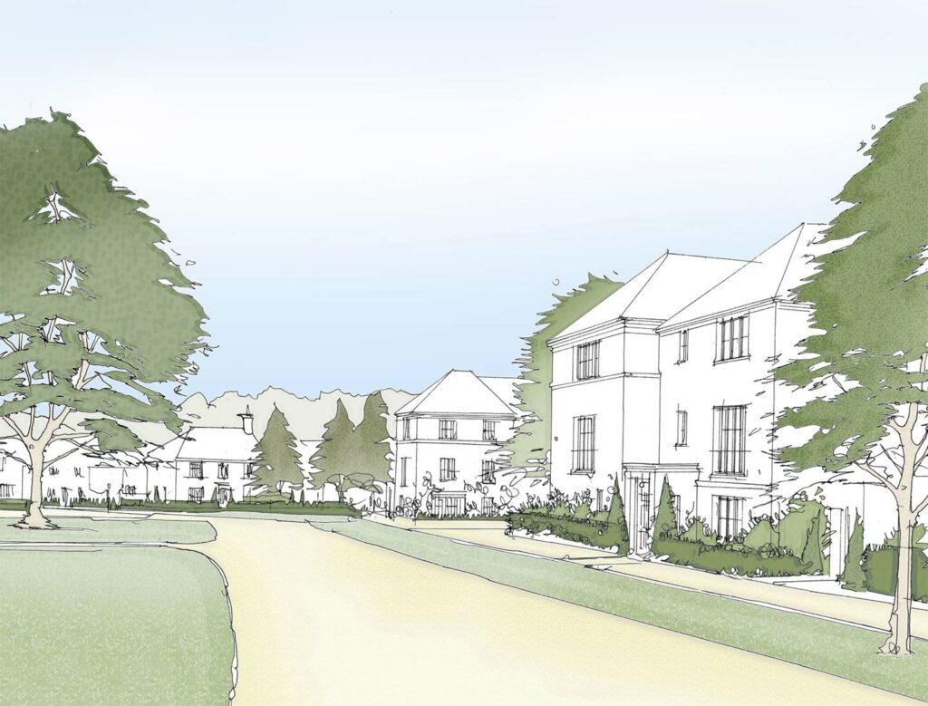
New homes and design
Meeting local need while responding to the character of Billericay
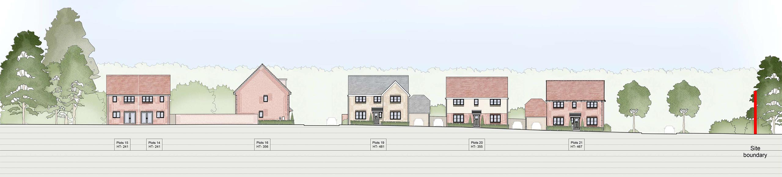
The development responds to the outline application and delivers new homes to help meet local need in a variety of house types and tenures.
The scheme includes a mix of 1- to 5-bedroom homes providing maximum opportunities for those looking to buy their first home, rent, move into a bigger family home or downsize. This includes apartments, terraced, semi-detached and detached homes.
All homes have been designed in line with the approved Design Code which has established clear principles on the character of key frontages and landscape areas.
Materials have been sensitively chosen to reflect the predominance of traditional materials within the Billericay Town Centre Conservation Area, and local heritage assets such as the Arts Centre on Laindon Road, utilising gable features on key buildings and using red and buff brick alongside both light and dark weatherboarding – all commonly found on the High Street in Billericay.
Open spaces have been sensitively designed to reflect other elements of the Billericay Town Centre such as the Queen Elizabeth Fields in Trust open space adjacent to Sun Corner, will extensive open space leading into the development proposal.
The homes will be built to achieve low carbon energy efficiency including no gas and electric vehicle charging points.
The parking strategy has been designed to accord with national guidelines and design standards as set out by Essex County Council. However, building on the protection of local heritage assets and landscape areas, parking is carefully managed throughout to maintain a strong landscaped-feel to avoid vehicle dominance.
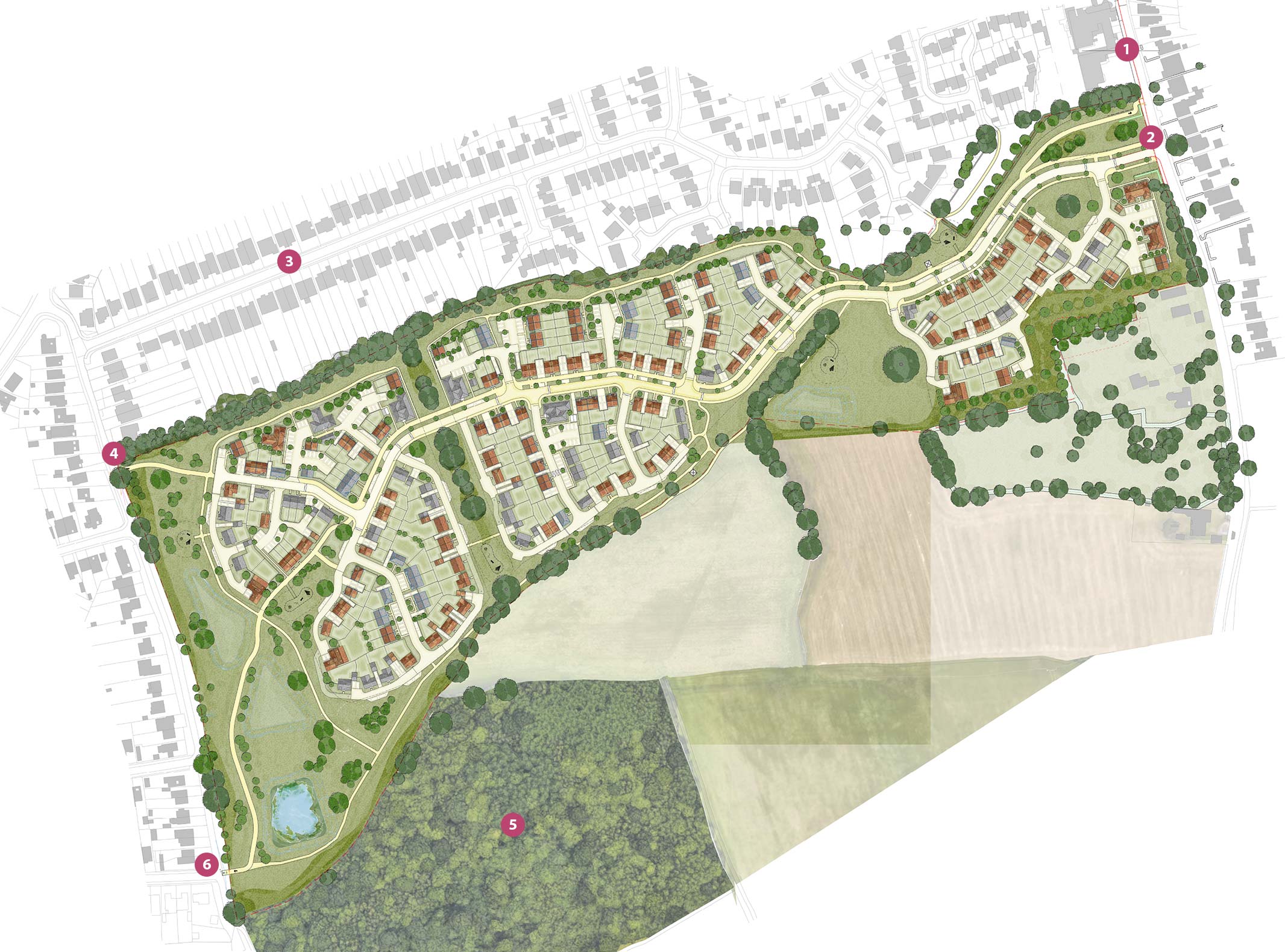
Landscape and biodiversity
Enhancing the area for people and wildlife
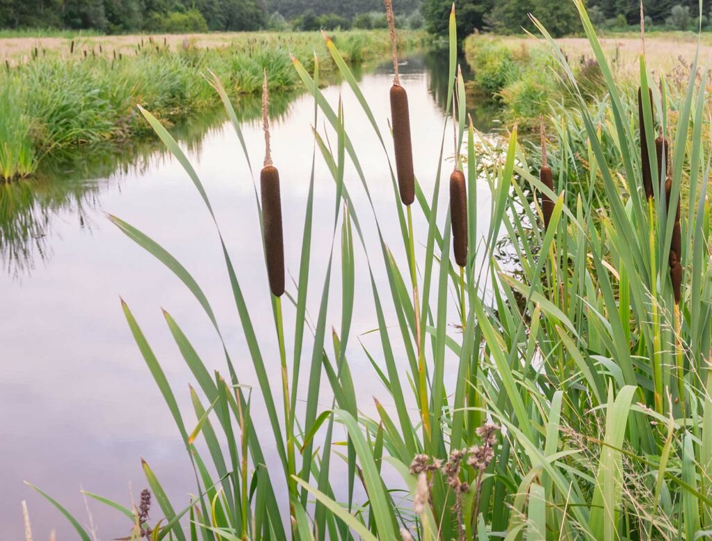
The proposals recognise the existing tree and hedgerow network which will be retained and enhanced across the site.
The scheme will deliver at least a 10% Biodiversity Net Gain through improved habitats, new planting and significant carefully considered landscaping – this is achieved by 42% of the site being delivered as green open space.
The play areas with new children’s play equipment have been designed to encourage recreation and play with informal play located throughout the landscaping proposals providing easy access and to encourage outdoor activity within walking distance of homes.
Pedestrian and cycle routes have been provided, which not only provided key east-west linkages but also provide a quality recreational route around the site, linking formal and informal areas of play.
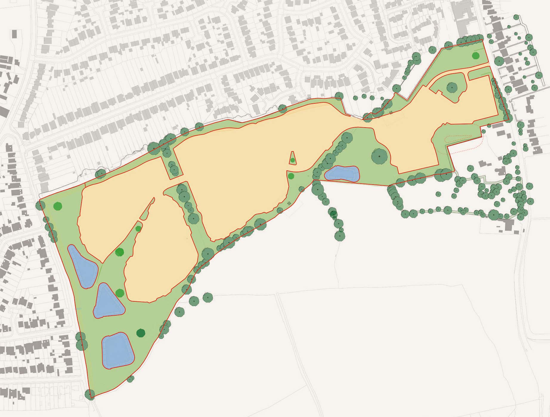
 Green space = 6.53 ha
 Suds = 0.80 ha
 Developable area = 8.41 ha
Access and movement
Delivering the agreed access arrangements
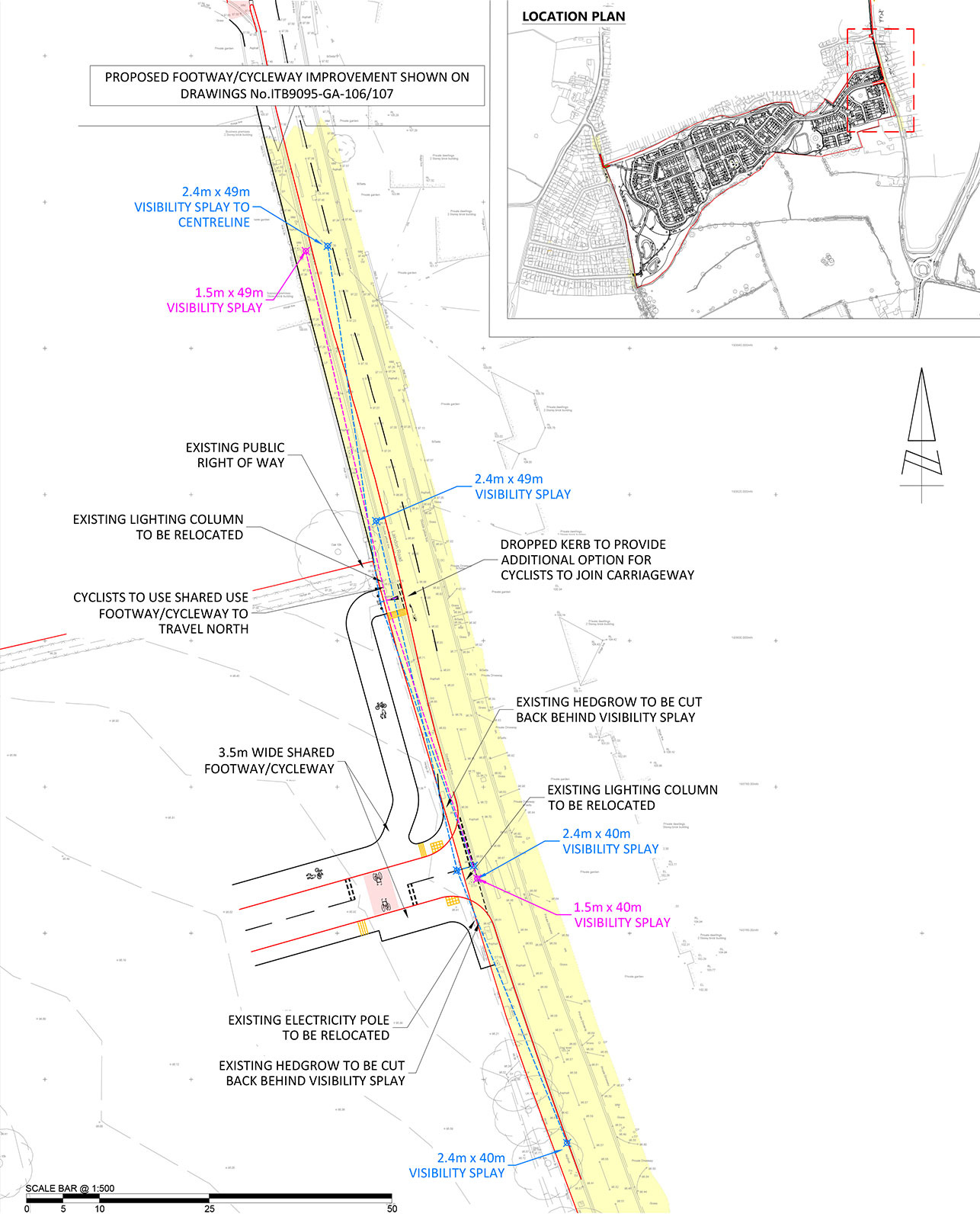
The development will be accessed via Laindon Road, which was approved as part of the outline planning permission. From here, the street network leads naturally into the site and has been designed to work well for cars, cyclists, pedestrians, emergency vehicles and refuse collection.
A series of new pedestrian and cycle routes will run across the site, creating a direct connection between Laindon Road and Frithwood Lane. These routes make it easy for people to walk or cycle to nearby schools, shops, open spaces and Billericay town centre. The site is also close to local bus stops and the train station, which offers regular services to London Liverpool Street and other destinations, helping to support sustainable travel for residents.

 Site boundary
 Highway boundary
Improved drainage
Drainage strategy that integrates with nature
To mitigate the impacts of the development on flooding, Countryside has worked closely with the Lead Local Flood Authority to design a scheme that not only works for the site and is future proofed to a 1 in 100-year storm event plus 40% for climate change.
The proposed drainage system introduces new Sustainable Drainage Systems (SuDS) and attenuation basins that have been carefully designed to integrate into the landscaping which also helps to create biodiversity and ecology rich areas across the site.